![]()
Pinkerton Area Map
|
Pinkerton Area Map
|
Sadie's Diary |
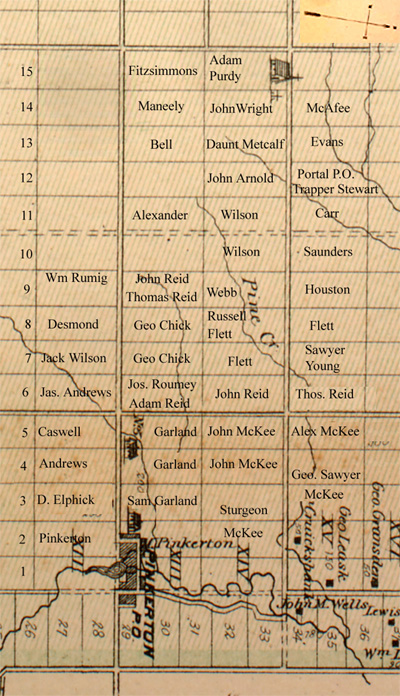
The 12th & 14th of Greenock, This is the area that Sadie Roumey mentions in her diary when she writes about going to the McKee's, Georgie Sawyer's, Metcalf's, etc. Everyone walked many miles as it is 1 1/4 miles from one concession to the next and from sideroad to sideroad. From the Roumey farm it is approximately one mile to Pimkerton, three miles to Cargill, five miles to Glamis, nine miles to Paisley and twelve miles to Walkerton. This map shows the family farms at about 1907. The Roumey, Reid, Metcalf and McKee properties are fairly accurate but the other farms have changed hands several times over the years and may not be exactly as shown. The "English Church" is shown in the lower left of Sam Garland's farm and SS #5 School is shown in the southwest corner of Lot 4, Concession XIV.. Purdy's Church is shown on the Adam Purdy farm and McKee's sawmill was at the back of the Geo. Sawyer farm. |
 |